Researchers from the University of Leicester have used remote sensing technology by Leicestershire-based aerial mapping company Bluesky in order to identify trees affected by a destructive disease.
Maps collected by airborne Laser sensors have, for the first time, been used to successfully pinpoint individual trees affected by the deadly larch tree disease.
The laser scanning surveys (LiDAR) were undertaken by aerial mapping company Bluesky and used to model tree canopy height as part of a wider study to prove the effective use of the technology for disease identification and monitoring.
Phytophthora ramorum is a fungus-like pathogen which causes extensive damage and mortality to a wide range of trees and other plants. Generically referred to as ramorum, the disease was first discovered in the UK back in 2002 and has now spread to sites from Cornwall to Scotland, causing destruction in high profile areas including Epping Forest and the Forest of Dean.
Professor Heiko Balzter, Director of the Centre for Landscape and Climate Research, lead investigator of the study at the University of Leicester and Co-investigator of the NERC National Centre for Earth Observation, said: “Invasive tree diseases pose a huge threat to Britain’s forestry. Diseases like Dutch Elm disease and Sudden Oak Death can wipe entire tree species from our landscapes within a few years. Climate change increases the risk of new tree diseases spreading across the UK.
“We hope that better ways of monitoring the outbreaks and spread of these diseases in our forests will help the Forestry Commission and private land owners to respond more effectively to such outbreaks.”
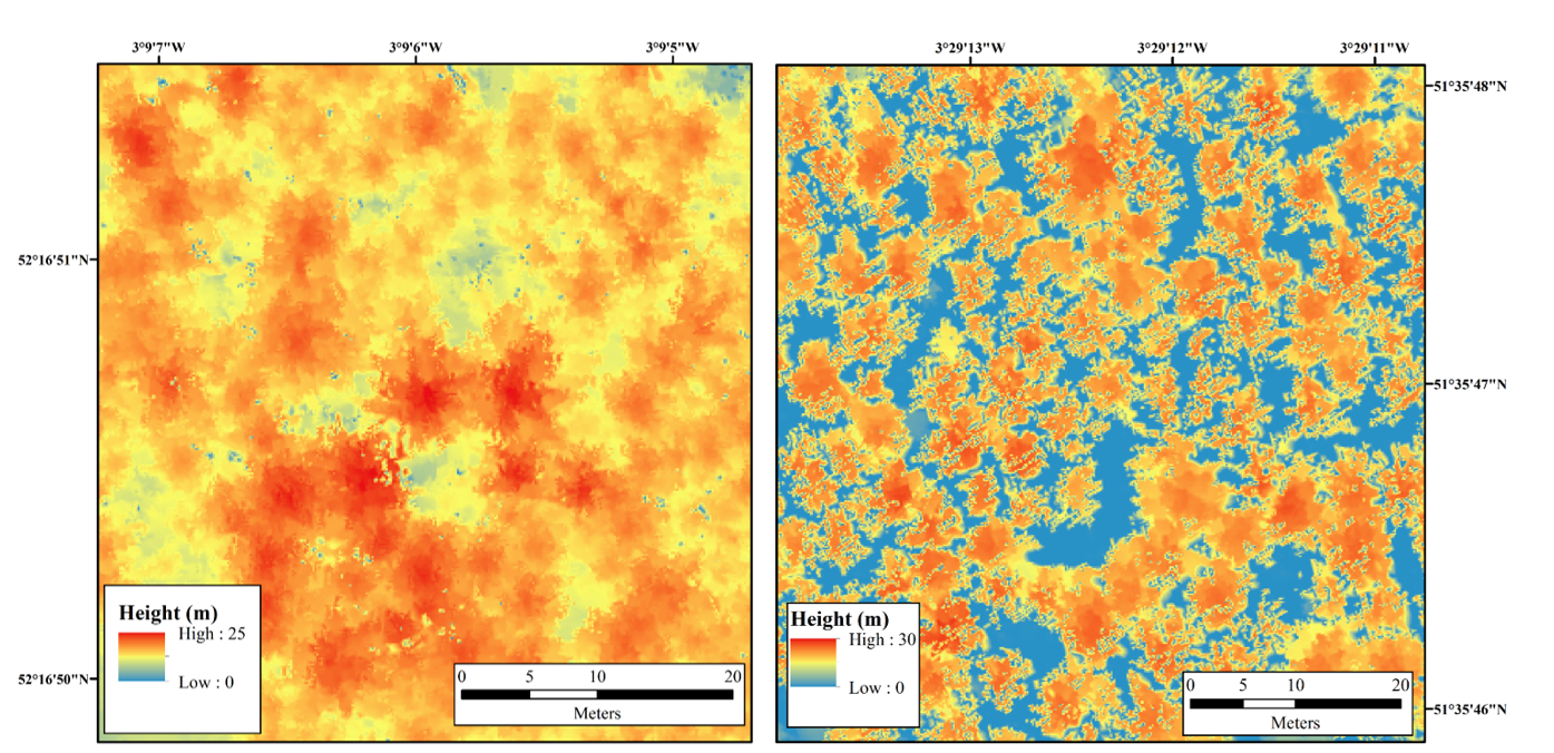
Aerial mapping. Left hand image is not infected; Right hand image shows infected area.
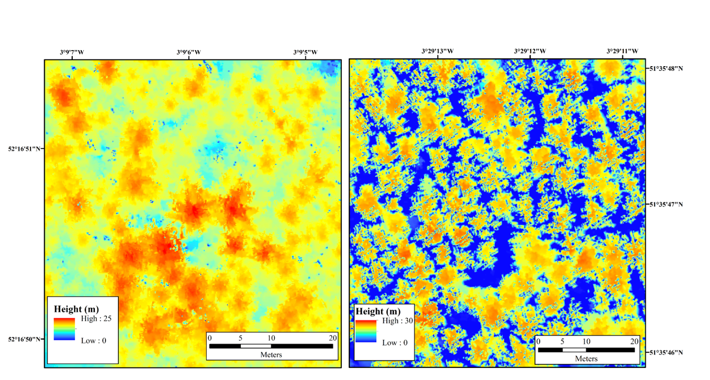
Aerial image. Left hand image shows material not infected; Right hand image shows infected material.
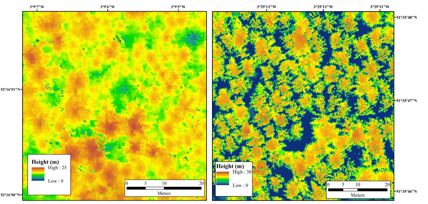
Aerial image. Left hand image shows not infected sample; Right hand image shows infected sample
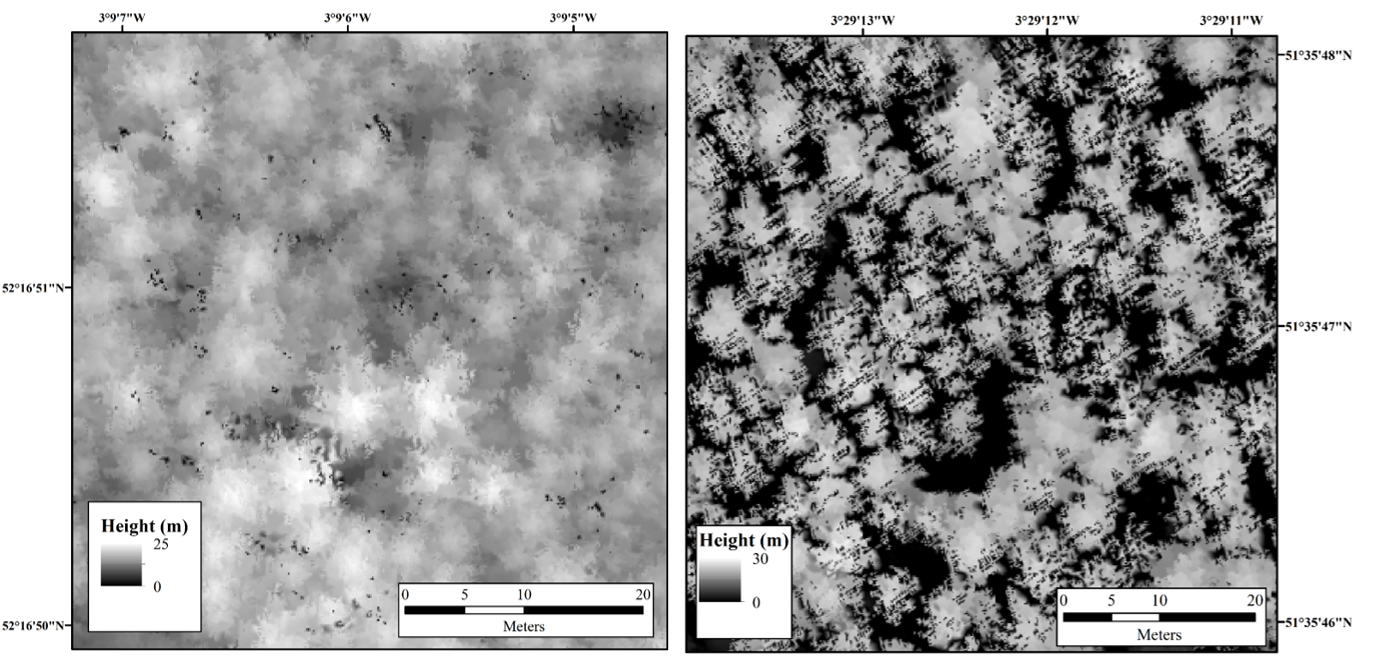
Black and white aerial image: Left hand image shows material that is not infected; Right hand image shows infected material.
Chloe Barnes, Postgraduate Researcher at the University of Leicester’s Department of Geography and lead author of the study, said: “Current trends suggest that UK forests and woodlands are subject to a greater threat from exotic diseases, such as Larch tree disease, than ever before.
“While the use of LiDAR in forestry applications has become more common, its use to identify individual trees affected by diseases has, until now, been underutilised.”
LiDAR has been used extensively to derive canopy height models (CHMs). It is one of the key datasets used to create Bluesky’s unique National Tree Map.
However, when trees are affected by disease, evidenced by defoliation and dieback, irregularities across the entire canopy add complications to the segmentation of individual tree crowns (ITCs).
Using the Bluesky LiDAR data, sample plots of two study sites in Wales were assessed using different segmentation algorithms. A series of raster format CHMs were computed at different pixel sizes and tested across a range of plantation larch plots in order to perform ITC delineation.
Chloe added: “The three dimensional nature of LiDAR provides structural information on topography, canopy height, tree density and crown dimensions, which we have proved can be used to determine biophysical parameters and inform forest inventories.
“The high resolution and accuracy of the data also enables the extraction of forest parameters associated with individual tree crowns, including the opportunity for the detailed study of forest condition and dynamics.”
Professor Balzter added: “University research in close collaboration with companies like Bluesky provides huge opportunities for turning research outcomes into real-world applications.”
The article, “Individual Tree Crown Delineation from Airborne Laser Scanning for Diseased Larch Forest Stands”, by Barnes, Balzter, Barrett, Eddy, Milner and Suárez is available for download at http://www.mdpi.com/2072-4292/9/3/231