A new study carried out by UKCEH and NCEO staff, at the UK Centre for Ecology & Hydrology (UKCEK), published in the journal PNAS, has found that land surface conditions frequently affect the direction and intensity of megastorms after they have formed.
In many regions of the world, travelling storm clusters known as Mesoscale Convective Systems (MCSs) are the dominant source of rainfall, and very little is known about their response to surface conditions once triggered.
Until now, it was thought that the path of these complex weather systems was largely unpredictable. However this ground-breaking scientific research will make it easier to predict the path of some of the world’s most powerful storms, enabling communities to better protect themselves from severe flooding.
NCEO scientist Professor Chris Taylor who is the co-author on the new paper comments: “The pattern of these megastorms is supposed to be difficult to forecast but we found a surprising level of predictability. Very dry soils influenced around half of storms in late afternoon or early evening, when they are at their peak. Further research and advances in satellite technology will increase our certainties about their movement. In decades to come, scientists will look back at this latest study as a gamechanger in the reliable forecasting of these devastating storms.”
The research is now helping scientists to develop online tools to better forecast the path and strength of an approaching storm, which will inform alert systems for communities across Africa, providing them with up to six hours’ warning. This includes Senegal, where UKCEH is working with the national meteorological service, ANACIM, to see how useful very short-term forecasts are for local emergency responses.
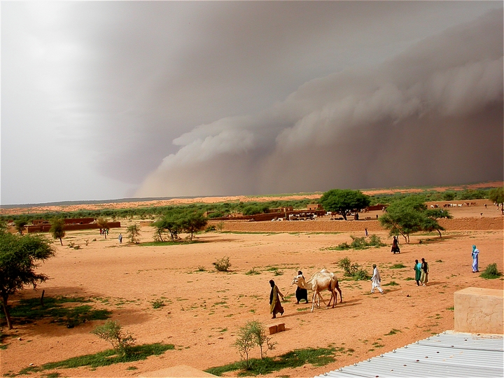
The researchers looked at satellite data on the activity of thousands of storms, plus land temperatures, in the Sahel for the period 2006 to 2010.
Lead author Dr Cornelia Klein of UKCEH explains: “It is well known that heat provides thunderstorms with great energy, but it was commonly thought that once they are moving, they were not affected by the state of the ground over which they travelled. However, we found that drier soils increased the intensity of an MCS mid-storm, affecting the amount of rainfall they release and also where they travel. Conversely, we found storms were often weakened over moister soils.”
“Our finding means that, for the first time, we can predict, from satellite-observed surface conditions, how these extremely large West African storms may behave when, for example, they approach a city. A more effective alert system will enable local people to take action to protect themselves as well as their homes, livestock and possessions, plus plan emergency responses.”
Flash flooding frequently occurs during the storm season in the Sahel, peaking between June and September, and can have a serious impact, with water entering homes and people losing property and a safe, dry space to live. Flooding can also cause sewage overflow from inadequate drainage systems, posing a health risk to humans and animals.
The study’s authors say the results have important implications for ‘nowcasting’ (forecasting for several hours ahead) of severe weather not just in the Sahel, but potentially other MCS hotspot regions of the world.
The study was funded by the Department for International Development (DFID) and Natural Environment Research Council (NERC) as part of the UK aid Future Climate for Africa research programme
To read more about this story click here
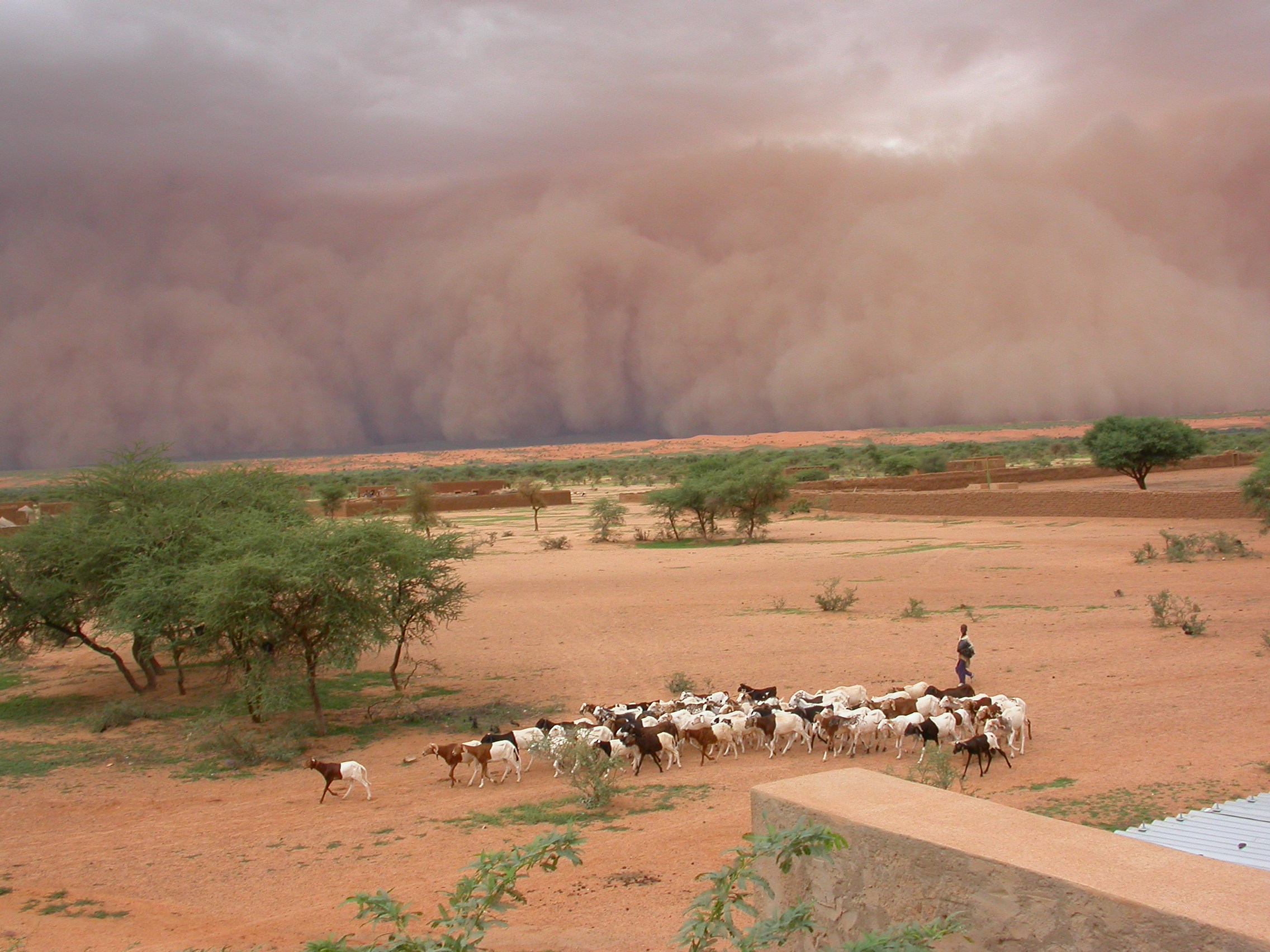
An Haboob in Mali Credit: Françoise GUICHARD / Laurent KERGOAT / CNRS Photo Library