

News and Media
Using Earth Observation to Prepare the UK for Increasing Heat Risks

A new policy briefing from NCEO and University of Leicester researchers highlights how satellite Earth Observation data could play a critical role in helping the UK prepare for increasing heat-related risks and build resilience to climate change.
The briefing, A National Heat Monitoring Service, calls for the establishment of a UK-wide service that uses satellite-derived Land Surface Temperature (LST) observations to provide near-real-time information on heat exposure, urban heat islands and emerging heat risks
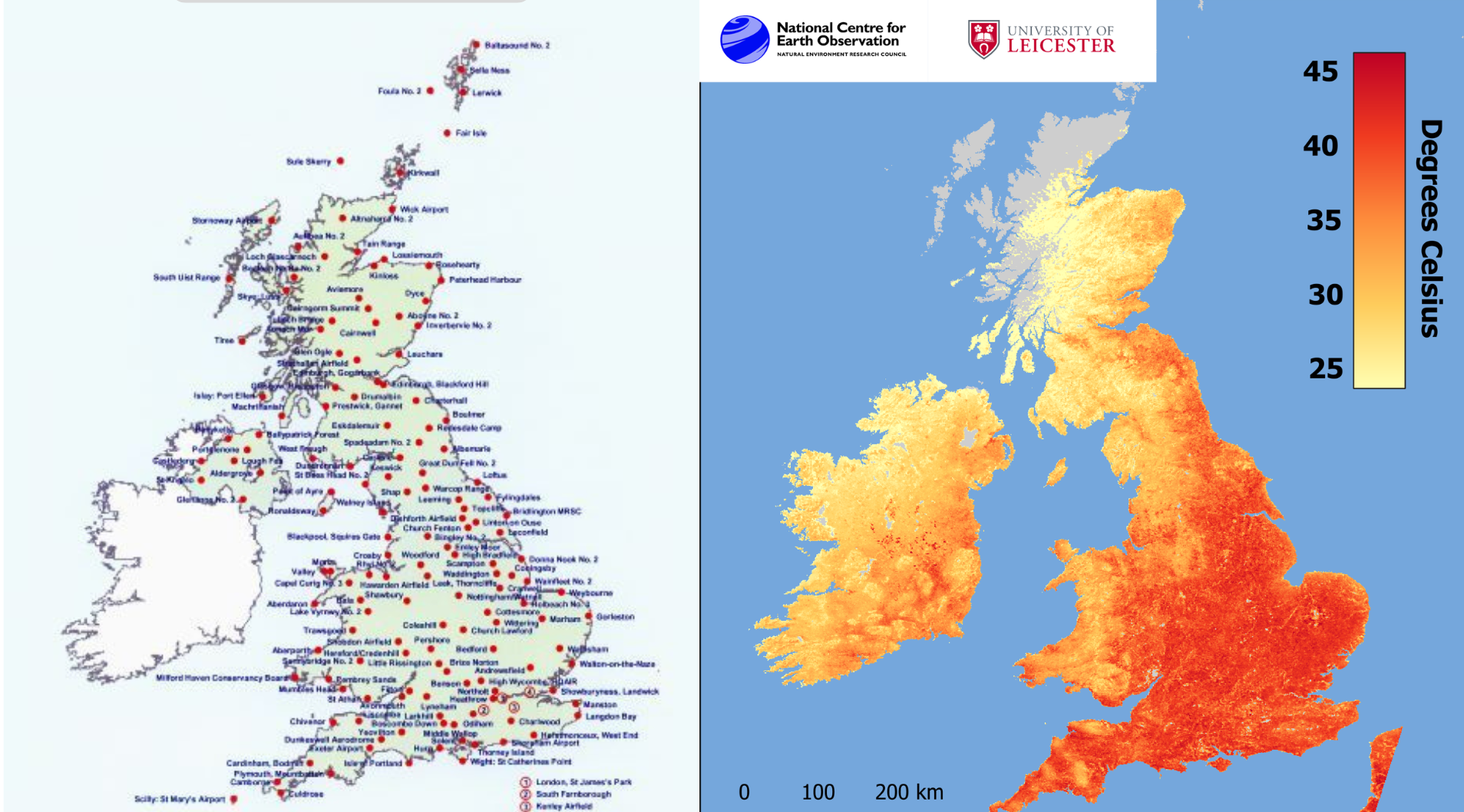
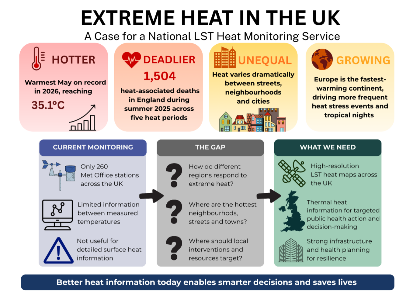
As heatwaves become more frequent, intense and longer-lasting, the authors argue that existing monitoring approaches, which primarily rely on air temperature measurements from weather stations, do not fully capture how heat is experienced at local scales. Satellite observations can reveal detailed patterns of surface heating across cities, neighbourhoods and regions, helping identify communities most vulnerable to extreme heat.
The briefing was produced by Dr Abigail Waring, NCEO Earth Observation and Climate Scientist, and Dr Darren Ghent, Head of the Surface Temperature Group at the University of Leicester, with support from the University of Leicester Institute for Policy.
Using Earth Observation to Strengthen Climate Resilience
Land Surface Temperature data derived from satellites provides consistent national coverage and can identify localised hotspots that may be missed by ground-based monitoring networks. According to the briefing, integrating these observations into a national heat monitoring service would support public health planning, infrastructure resilience and climate adaptation efforts across the UK.
The proposed service would bring together expertise from organisations including NCEO, the Met Office, the Environment Agency, the UK Space Agency and the wider UK Earth observation community.
The authors recommend the development of a publicly accessible UK Heat Dashboard that could provide:
- Near real-time monitoring of land surface temperatures across the UK
- Identification of heatwave hotspots and urban heat island effects
- Regional heat exposure indicators for local authorities
- Historical analysis to support climate adaptation planning
- Data products for public health, infrastructure and emergency response applications
- Annual reports tracking heat exposure trends and vulnerable communities
Building on Existing UK Earth Observation Capability
The briefing highlights how the service could build on existing UK Earth observation infrastructure and satellite data streams, including capabilities developed through NCEO and services such as the Earth Observation Data Hub (EODH). By leveraging established Earth observation platforms and expertise, a national heat monitoring service could be implemented efficiently while providing valuable information for decision-makers across government, health and environmental sectors.
The authors argue that recognising heat as a major climate hazard alongside flooding and storms would strengthen the UK’s ability to prepare for future extreme weather events and support evidence-based climate adaptation policies.
Read the Briefing
The full policy briefing, A National Heat Monitoring Service: Using satellite Land Surface Temperature observations to strengthen heat resilience, public health preparedness and climate adaptation across the UK, is available through the University of Leicester Institute for Policy.
Share this article


Published by Fazila Patel
Digital Comms Officer
University of Leicester
Latest News and Events
