
News and Media
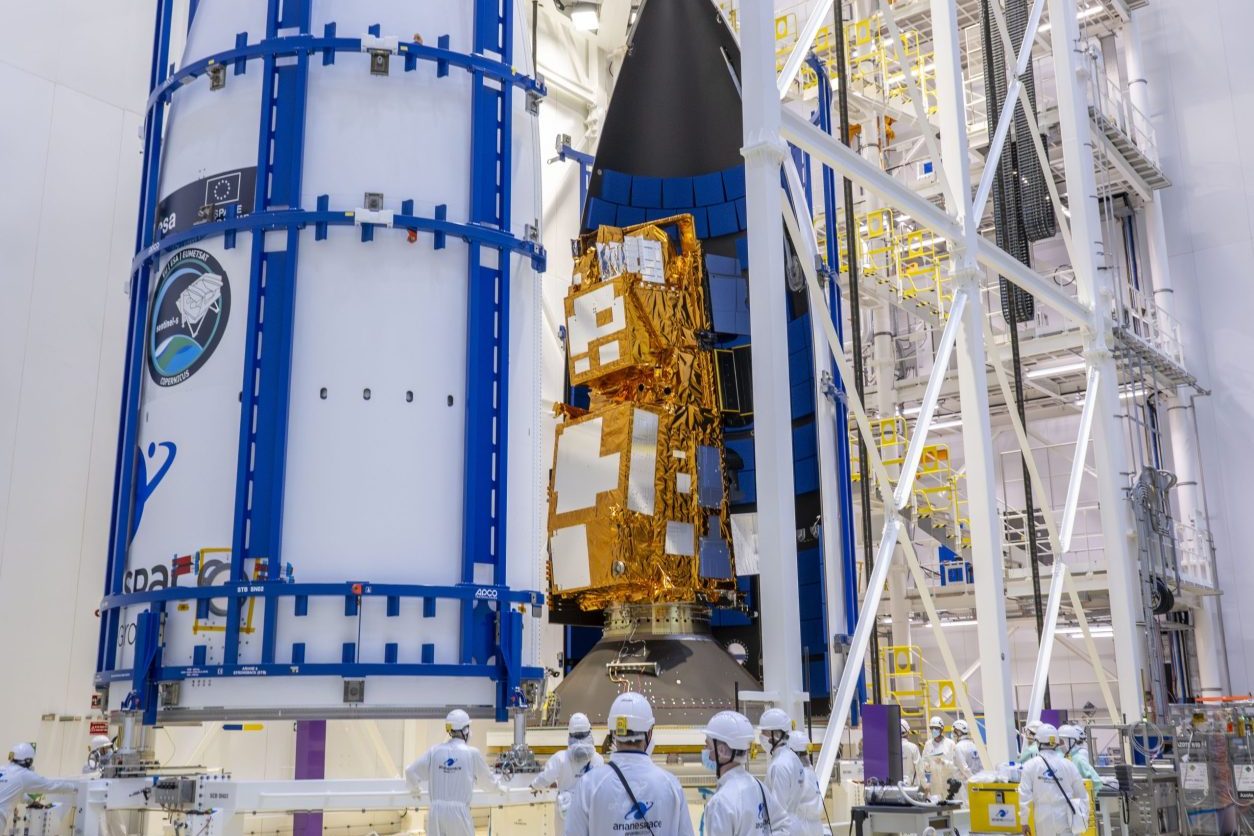
Credit: ESA-CNES-ARIANESPACE/Optique vidéo du CSG–T. Leduc
MetOp-SG-A1 – New ESA Satellite to Boost Climate and Weather Monitoring to Launch

On 12 August, at 9:37pm local time in Korou, French Guiana (UK time 01:37am Wednesday morning), an ESA Ariane 6 rocket will launch the first of a new generation of EUMETSAT satellites into a polar orbit around 820 km above the Earth’s surface.
The satellite MetOp-SG-A1 (“SG” stands for second generation) will circle the globe each day, gathering detailed information to support climate science, environmental monitoring and weather forecasting.
Why Long-Term Records Matter
Long-term records are vital for understanding how our planet is changing. Data from MetOp-SG A1 will align with that from its first-generation predecessors (two of which are still operational), ensuring the continuity climate scientists require for climate research. However, several of the new datasets will offer much finer detail – able to detect changes over just a few kilometres instead of tens of kilometres – as well as greater accuracy.
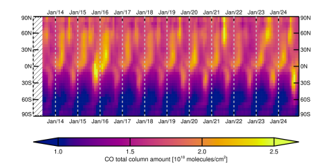
At the National Centre of Earth Observation (NCEO), we are particularly looking forward to continuing and improving our long time-series of methane, carbon monoxide, water vapour and temperature measurements as well as researching fine-scale phenomena across the world. These records have been derived from the Infrared Atmospheric Sounding Interferometer (IASI) which is able to detect some of key gases which capture the complexity and evolution of atmospheric chemistry.
Next-Generation Instruments Onboard
Alongside updated versions of instruments from first-generation Metop satellites, Metop-SG A1 carries new technology, including the multi-viewing multi-channel multi-polarisation imager (3MI) which should give us much better information about types of aerosol (small particles or droplets suspended in the atmosphere such as dust, city aerosol or wildfire particles).
It also includes the Sentinel-5 spectrometer, based on the TROPOMI instrument aboard the Copernicus Sentinel-5P mission. This sensor measures light from the ultraviolet to the near-infrared to monitor gases from the ultraviolet (UV) to the near infrared (NIR) to monitor atmospheric gases, aerosols and cloud properties that affect climate, air quality and UV index.
NCEO and RAL Space Remote Sensing Scientist Dr Richard Siddans, has contributed to preparing Sentinel-4 and Sentinel-5 data for many years and sits on the Mission Advisory Group. Dr Siddans and colleagues are involved in developing the operational processors and will be involved in the instrument’s commissioning phase after launch.
My colleagues from RAL Space and NCEO have been involved with both hardware development and data processing for the MetOp-SG and Sentinel-5 missions, and after years of dedication, it’s incredibly exciting to see these missions finally launch.
Dr Richard Siddans
Insights from the MetOp-SG series will benefit weather forecasting, environmental monitoring and policy-making for decades to come. It’s a significant leap forward in our ability to monitor atmospheric composition from space.”
NCEO and RAL Space Remote Sensing Scientist
Other instruments on MetOp-SG A1 will examine different ranges of the electromagnetic spectrum, enabling observations of diverse, weather-significant parameters such as ice clouds and surface temperature. Comparing and combining observations from these not only allows datasets to be cross-checked, but also makes it easier to distinguish between similar signals. This will allow us to make huge progress in understanding complex atmospheric chemistry and the interactions between surface emissions (such as those from wildfires, cities or vegetation) and air quality.
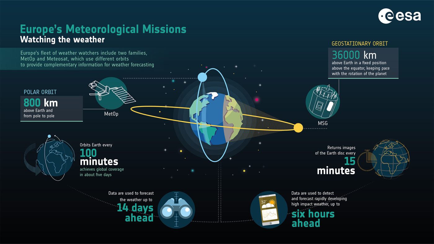
Working in Tandem with Meteosat
MetOp-SG 1A will work in tandem with the third-generation Meteosat satellites – MTG-I1 (Meteosat 12) and MTG-S1 (launched at the start of July) – in geostationary orbit 36,000 km above Europe. Meteosat 12 captures half-Earth images every 10 minutes, while MTG-S1’s Sentinel-4A instrument provides hourly daylight measurements of key atmospheric pollutants over Europe.
From Forecasting to Public Health Protection
Data from Metop satellites enables scientists to put these frequent measurements into a global context so they can make longer-term weather forecasts and track how gases that impact climate and human health are transported across the world. This allows national and local governments or agencies to issue appropriate warnings and advice to vulnerable people (such as the elderly and those with respiratory problems) almost immediately when air quality drops. It also means that we can explore the impact of unexpected events, such as methane releases or volcanic eruptions in near real-time.
Looking Ahead: Metop-SG B1 and Beyond
The next satellite in the series, MetOp-SG B1, is scheduled to launch early next year. It will carry a different suite of instrument, complementing A1 and the MTG satellite to improve forecasts and inform strategies for tackling environmental challenges such as soil moisture changes, flooding and drought – all of which impact food production.
These datasets will also combine data from other missions including the recently launched MicroCarb (CNES/UK Space Agency) and the upcoming Copernicus CO2M mission , to gain even deeper insights into specific aspects of the Earth system.
With further MTG and MetOp-SG launches planned by EUMETSAT into the 2040s, we can look forward to decades of world-leading science and the development of practical applications that directly benefit people while advancing our understanding of our changing planet.
Learn more from NCEO Director Prof John Remedios on ITV News
Watch the MetOp-SG-A1 Launch Live
Share this article


Published by Fazila Patel
Digital Communications Officer
University of Leicester
Latest News and Events
