
News and Media

Earth Observation Data Hub: Supporting Innovation Across Research, Business, and Government

At the National Centre for Earth Observation, we are committed to making Earth Observation (EO) data more accessible, usable, and impactful. One of the key ways we’re doing this is through the development of the Earth Observation Data Hub (EODH) – a platform designed to simplify the discovery of EO data from a wide range of sources, all through a single point of access.
While the platform is still in a pre-operational status, we’ve been working closely with early users across different sectors to explore how the EODH can support real-world applications. We’re now pleased to share three new case studies that demonstrate the platform’s versatility and value across research, business, and government.
Research
The National Physical Laboratory (NPL) use the EODH to support their research operations, particularly in the validation and calibration of optical EO data. By accessing high-resolution commercial data programmatically, NPL are able to streamline their workflows and focus on building robust Quality Assurance (QA) metrics rather than data wrangling. Their experience highlights the EODH’s potential to optimise scientific workflows , by reducing the friction in data access.

A new generation of high-accuracy SI-Traceable satellite “SITSat” missions aim to serve as “gold-standard” references for satellite calibration. This case study demonstrates how high-resolution commercial satellite data via EO DataHub can support development of more detailed models to improve understanding of satellite calibration and validation uncertainties.”
Business
Dalcour Maclaren – Supporting Measurements of Biodiversity Net Gain Using High-Resolution Commercial Earth Observation Data
Infrastructure and environmental consultancy Dalcour Maclaren explored the EODH as a tool to support their planning and environmental assessment work. The ability to quickly locate and access relevant EO datasets helped them enhance project site mapping and derive informed recommendations for clients. This case study illustrates how the EODH catalogue can serve as a valuable data source for commercial users seeking to integrate EO data into their existing business workflows.
Recent advancements in the resolution and availability of satellite imagery have the potential to aid the UK’s goals for sustainable development in the construction industry, by helping to measure and understand habitat biodiversity.”
Government
NatureScot – Seagrass monitoring in the Sound of Barra, Outer Hebrides, Scotland
Scotland’s nature agency, NatureScot, engaged with the EODH to explore its use in environmental monitoring for marine conservation projects. The platform enabled them to search for cloud-free EO optical imagery over a Special Area of Conservation (SAC) —critical to the stewardship of protected habitats at that site.. Their case study demonstrates how the EODH can support fitness-for-purpose assessments of comparable EO datasets, to inform evidence-based environmental management decision-making..

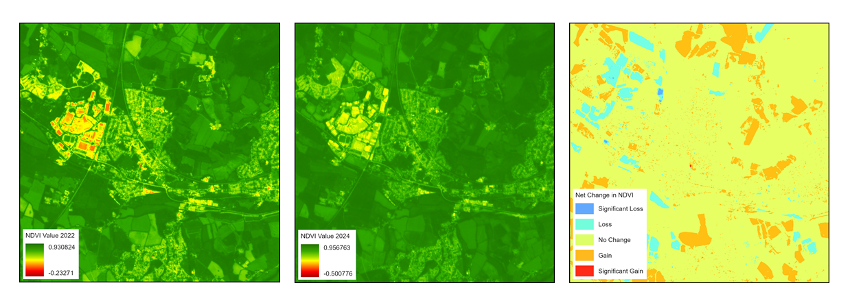
High resolution imagery is essential for monitoring the seagrass at the Sound of Barra, on the west coast of Scotland in the Outer Hebrides.”
You can read all three case studies in full here: EODH Case Studies
A Platform for All Sectors and an Invitation to Collaborate
These case studies reflect the EODH’s core strength: bringing together diverse EO datasets into one accessible, user-friendly platform. Whether you’re a researcher, a business analyst, or a government policymaker, the EODH is designed to help you find the data you need – faster and more efficiently.
Although the platform is not yet officially open to the public, they are actively seeking expressions of interest from organisations who would like to explore using the Hub for:
- Operational workflows
- Data processing pipelines
- One-off studies or pilot projects
- Transitioning existing processes into a more streamlined EO data environment
Technical support is being offered to help selected users integrate their processes into the Hub and evaluate its potential for their needs.
Get Involved
If you have a process, workflow, or study in mind that could benefit from easier access to EO data, the EODH team would love to hear from you.
Please contact enquiries@eodatahub.org.uk with a brief description of your intended use. Proposals will be reviewed on a case-by-case basis, and the team will work with organisations to explore how EODH can best support their objectives.
Together, we can shape a platform that meets the evolving needs of the EO community – and unlock the full potential of Earth Observation data for the benefit of science, society, and the environment.
Share this article


Published by Fazila Patel
Digital Comms Officer
University of Leicester
Latest News and Events
