NCEO scientists are combining our need for detailed measurements with their passion for surfing to fill gaps in our understanding of coastal seas and how they may change.
Measuring the temperature at the surface of the ocean is crucial to understanding its biological, physical and chemical environment. The sea surface temperature (SST) influences how gases move between the sea and the atmosphere, the distribution and feeding of marine animals such as fish, whales and seabirds, and may impact global and regional climates. Any changes in SST can have major effects on how the ocean behaves and on the life it sustains. Understanding the changing environment and the potential ramifications of climate change depends on accurate measurements and regular monitoring.
In the open ocean, satellites with specially tuned sensors are used to measure SST with coverage over large areas on a regular time frame; the reliability of these remote measurements is validated by many in situ observations from ships, autonomous sensor-bearing floats and other platforms. Perhaps surprisingly, closer to the coast the picture is less clear and due to a limited number of in situ measurements, little is known about the accuracy and precision of the satellite Earth observation (EO) data in the near shore region.
Coastal seas are ecologically and economically very important but they are highly variable and that variability makes it harder to get good measurements from satellites. Plymouth Marine Laboratory has been monitoring a wide range of environmental variables for decades through its regular sampling and autonomous collecting at the L4 and E1 stations, 7km and 33km off the coast of Devon, but measurements at the coast are much less frequent.
Now Dr Bob Brewin (NCEO-PML) and his colleagues have combined their science and their hobby to fill in the gaps, get more data and use it to test the satellite observations. “We have quite a lot of data from parts of our local coastal seas but there is a massive community of people using the sea on a regular basis, and if we could harness them, it could provide a wealth of measurements”, said Brewin.
To test whether this approach might work, five surfers were equipped with temperature sensors and a GPS recorder, to link temperature measurements to the location of the surfers. Nearly three hundred surf trips, over three years, were conducted with the median of the readings in the water being used to represent the water temperature.
In order to assess the accuracy of the satellite readings, the data from the surfers and the two autonomous buoys were compared – effectively three sets of readings taken at the same time in more-or-less the same place. The data from the offshore autonomous buoys agreed well with the satellite measurements. The data collected by the surfers matched very well with that from the autonomous buoys, allowing for the separation of the sites, however, the surfers’ data differed from the EO measurements, indicating “a significant reduction in performance” of the Advanced Very High Resolution Radiometer (AVHRR) satellite sensor when it came to retrieving SST at the coast. The hope is that measurements like these will be used to improve satellite measurements, which could improve the retrieval of temperature data around the world.
Brewin and his colleagues are not alone in trying to improve the quality of measurements and have begun a collaboration with Scripps Institution of Oceanography, in the US, testing a surfboard fin designed to measure temperature. So might surfers provide the link that could improve readings?
“We have shown that there is considerable potential in ‘tagging’ recreational water users”, Brewin commented. “In the UK alone we could get around 40 million measurements of SST just from the surfing community, if all had sensors, in the US that could be as many as 350 million readings per year. When you consider that surfers often visit some of the most remote locations across the globe, locations that may be especially vulnerable to climate change and hence SST changes, the opportunity is immense. Increasing the coverage and frequency of these in situ measurements, through ‘citizen science’ participation will not only help us to refine the satellite sensors and how we interpret their readings, but will have an immediate impact on our understanding of how coastal waters may be changing”.
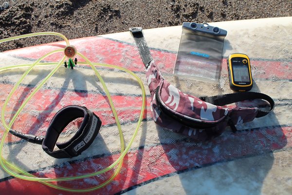
GPS and sensor equipment used to capture data
Further Information
Evaluating operational AVHRR sea surface temperature data at the coastline using surfers. Robert J.W. Brewin, Lee de Mora, Oliver Billson, Thomas Jackson, Paul Russel, Thomas G. Brewin, Jamie D. Shutler, Peter I. Miller, Benjamin H. Taylor, Tim J. Smyth, James R. Fishwick. Estuarine, Coastal and Shelf Science 196 (2017). http://dx.doi.org/10.1016/j.ecss.2017.07.011
The research was led by NCEO at Plymouth Marine Laboratory in collaboration with the University of Plymouth, Chatham & Clarendon Grammar School, and the College of Environmental Sciences, University of Exeter.