NCEO Earth Observation Scientists – along with Data Scientists from the Centre for Environmental Data Analysis – will demonstrate how we use satellites to monitor the Earth’s environment from space. We will have hands on activities to show you how we measure the temperature of the Earth and monitor land use changes.
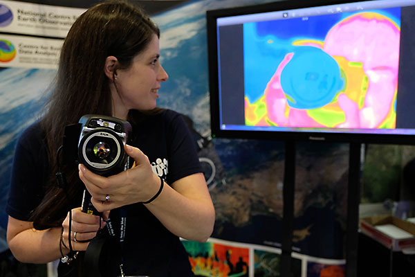
Infrared cameras are used to see ‘heat’, otherwise invisible to us. Come and see how scientists use these cameras on board satellites to see the invisible and understand our planet. Try your hand at thermal painting, melting icebergs and see if you can make yourself invisible. Understanding heat on Earth, especially in the sea is a key part of how our scientists understand our weather and climate.
Look at images of the Earth from space, can you see human features as well as natural ones? Try colouring in some images taken by British ESA Astronaut Tim Peake and learn more about land use change. Can you spot the difference between an Astronaut and satellite image of the Earth? Come and try our quiz to find out.
Come and learn about monitoring the environment from space at our exhibition stand, 17th – 19th November 2017, Dynamic Earth, Edinburgh!